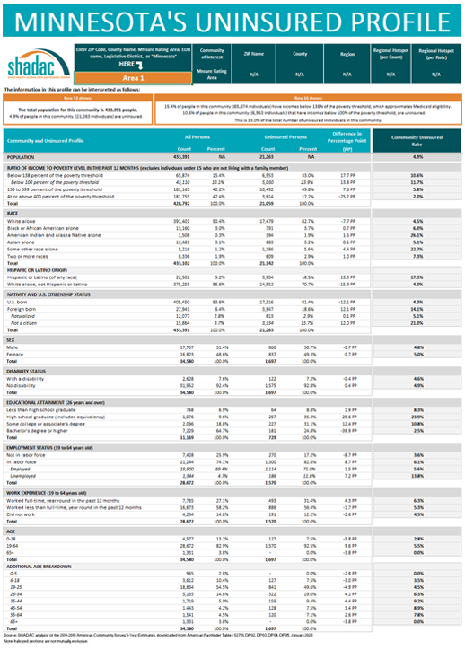
After a successful initial release of a new, interactive data tool that provides a way to identify and characterize communities with high uninsurance rates in Minnesota, Dr. Kathleen Call and her team at SHADAC have continued their partnership with the Blue Cross Blue Shield Foundation of Minnesota through a just-released update to the profile tool, which incorporates new geography by which users can now view the state’s uninsured population—MNsure rating areas, the geographic regions health insurers use to set premiums on MNsure.
The original version of this profile tool provided rates and counts of the uninsured in Minnesota that were focused specifically on classification by ZIP code level (i.e., Census-defined ZIP code), allowing users to compare characteristics of the total population to the uninsured population in a specific ZIP code as well as providing an in-depth profile of community characteristics. An interactive map that accompanies this tool also shows users the geographic makeup of each ZIP code in relation to schools, hospitals, native reservations, and other important or distinctive landmarks.
In the updated version, users are able to look at rates and characteristics of the uninsured not only by their ZIP code area of interest—or by the state as a whole, or by region, or by county, by state legislative district—but also by MNsure rating areas. By adding this layer of definition, Dr. Call hopes to continue the work of refining the tool and making it more useful in supporting targeted outreach and enrollment activities of health insurance navigators.
To download the Uninsured Profile, access additional information, or to request the development of a similar tool for another state, visit the "Minnesota's Uninsured Profile Resource" page.

