March 01, 2024
|  |
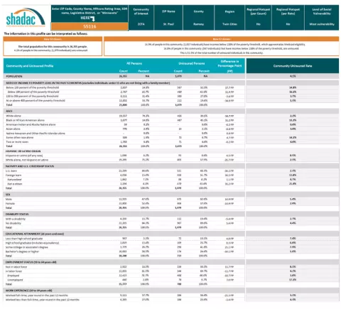
Five-year American Community Survey estimates have been released for 2022, which means that SHADAC researchers have updated our ‘Minnesota Community and Uninsured Profile’ to include this latest data.
This resource, originally created as part of the ‘Minnesota’s Uninsured and the Communities in Which They Live’ project funded by the Blue Cross and Blue Shield of Minnesota Foundation, aims to:
- Provide information on Minnesota uninsured people and populations
- Assist policymakers in developing & evaluating enrollment and outreach strategies
- Understand uninsured community and population characteristics in Minnesota
- Create a tool that can be used to understand and evaluate equity work, inform strategic planning, assess community needs, and support grant writing for related and relevant programs
With each release of ACS data, SHADAC updates this profile with new estimates and analysis. With this latest update, the profile includes five-year data from 2018 – 2022 in an organized Excel workbook. The workbook includes various tabs, including:
- How to Use - an overview on using the uninsured profile to both identify and gather information communities of interest
- Community and Uninsured Profile - the profile itself with breakdowns at the county, MNsure rating area, ZIP code, economic development region, and state levels
- ZIP Code Uninsured Rates - includes all reported Census-defined ZIP Codes, regions, and counties in Minnesota along with both the number and percent of uninsured within those communities
This data resource allows policymakers, researchers, and community members themselves to explore and understand the current landscape of uninsurance in Minnesota. Whether it is used to support equity-focused work, community needs assessments, grant writing, or targeted coverage programs, this tool can provide key information that can drive policy, outreach efforts, and much more.
Learn more about the profile and download the data here, where you can also learn more about how to use the profile, including a tutorial video.
Want to learn more about how we made this profile? Curious about its applications? Contact us here – we are always happy to discuss.

